Name of Pilot area: Marchfeld
Country: Austria
Region: Lower Austria
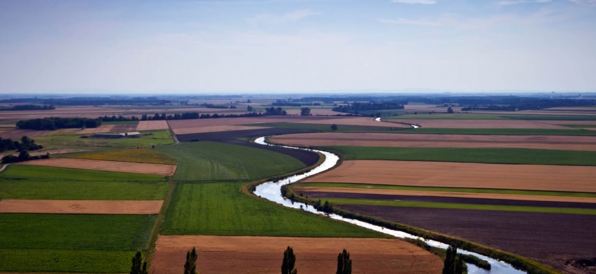
Altitude / Topography: Flat topography with an altitude of ~ 160-180m above sea level
Climate type: Continental
Average annual rainfall: ~550 mm
Average annual ET: ~640 mm
Challenges: Regulation of surface water to provide aquifer recharge. Groundwater level and water quality problems due to intensive agriculture
User(s): AGES (government agency); Farmers and cooperatives; Marchfeld Kanal authority
Pilot focus: EO-based VRT; upscaling practice
Current situation:
Marchfeld in Austria is the main production area of vegetables in Austria. It is located at the North-Eastern border of Vienna (Lat. 48.20°N, Long. 16.72°E) in the federal state of Lower Austria and has a total size of app. 900km². Around 75% of the area is used for agriculture – this is the highest value in Austria. Around 30% of the agricultural area is irrigated.
The farm structures are large and economically viable compared to other areas in Austria. There are 884 farms with more than two-thirds (72%) professional farms where farming is the only source of income. The average size of a farm is around 55ha and there is an upward tendency towards less farms with larger areas and an increasing number of organic farms.
Marchfeld has a flat topography with an altitude of around 160-180m above sea level. The region is characterized by a semi-arid climate with an average annual precipitation of 500–550 mm that can drop to 300 mm making it the driest region of Austria. Precipitation during the growing season (April–September) is 200–440 mm. The average temperature is between 9-10°C and evapotranspiration is around 640mm (1993, Dobesch).
A canal (“Marchfeldkanal”) was built from 1986 to 2004 to improve the groundwater conditions –quality and quantity – in the Marchfeld. In addition, the channel serves as flood protection, revives old watercourses and provides local recreation possibilities. The water from the canal diverted from the Danube is used for recharge of the groundwater and – to a lesser extent – directly for irrigation.
The dominant soil types are Chernozem and Fluvisol, based on the Food and Agriculture Organization (FAO) World Soil Classification. The general soil conditions are characterized by a humus-rich A horizon and a sandy C horizon, followed by fluvial gravel from the former river bed of the Danube.

